by Peter B. Dannenberg
In 1775-1776, Benedict Arnold and Richard Montgomery invaded Canada. Americans needed more troops and supplies to siege Quebec. Colonel Jacob Bayley led the northern frontier militia from Newbury, Vermont. He urged General Washington to build a shorter road. Washington, without waiting for Congress, approved the plan on April 29, 1776.
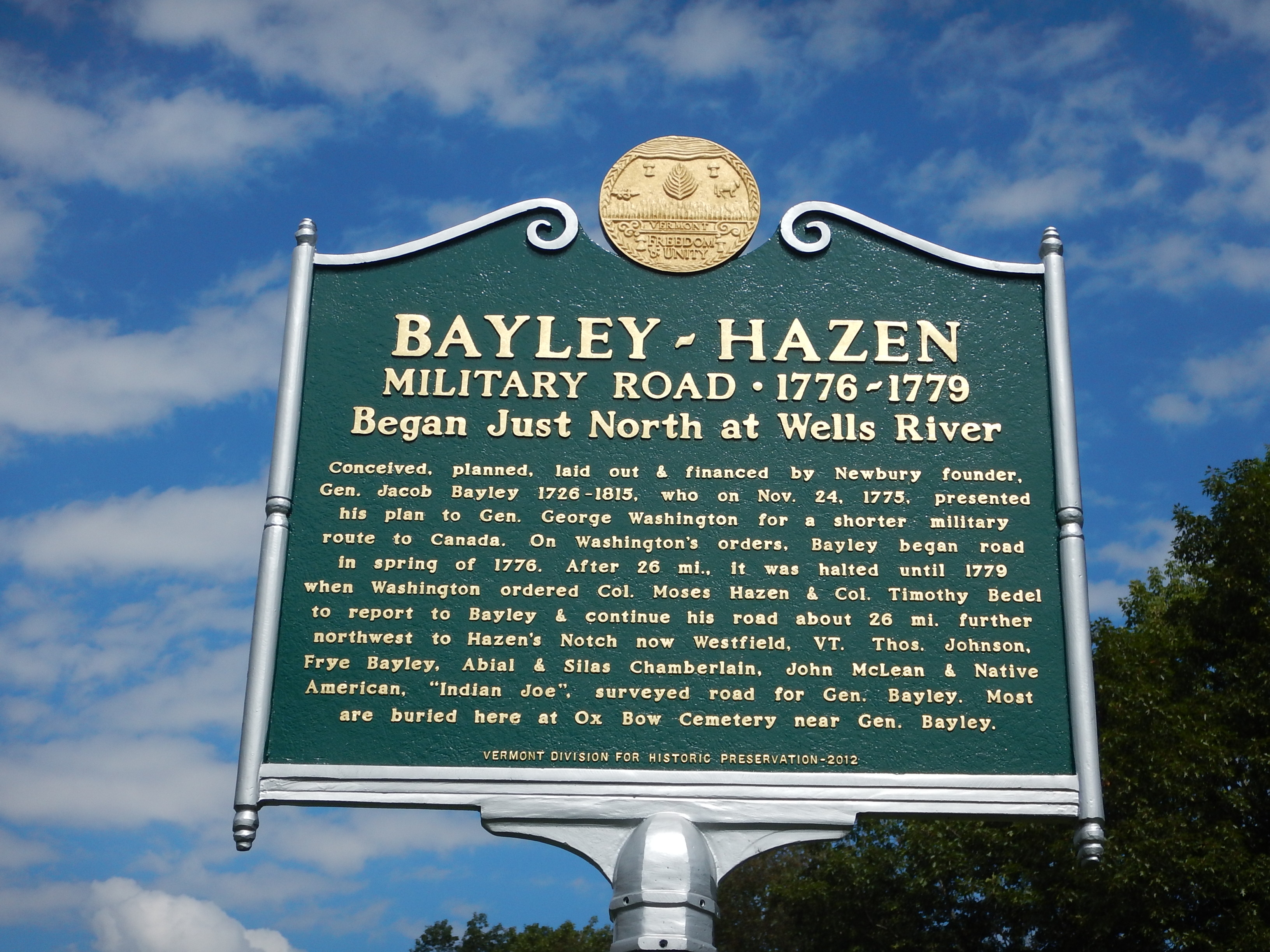
In five days, they reached Lake Champlain, and stopped at Simon Metcalfe's fur trading post at the mouth of the Missisquoi River, on Shad Island, in Swanton Falls. Metcalfe's served as an inn, near the Canadian border. Another five days brought them to St. Johns. They blazed 92 miles.
A regiment on snowshoes followed. Jonathan Elkins, Jr., years later, wrote, ". . . in March 1776, part of Butler's Rigmen (sic) was going through the woods to St. John's". Probably this was Timothy Bedel's Regiment. It started as one ranger company, in Coos, N.H., May 26, 1775, to guard the northern frontier. From July 1775 to January 1776, eight more companies of backwoodsmen from northern New Hampshire joined. They fought at the Siege of Fort St. Jean and the Battle of the Cedars, where most surrendered on May 19, 1776. They were released after eight days. The same number of British prisoners was to be exchanged, but Congress reneged on the agreement. The Bedel regiment disbanded January 1, 1777, at Coos, when enlistments expired.
James Whitelaw of Ryegate, Vermont surveyed and marked road boundaries. (Ten years later, he led the survey of the Town of Cabot.) Joseph Sussap "Indian Joe" was a scout. (Sussap is the Abenaki pronunciation of Joseph. He called himself Indian Joe.)
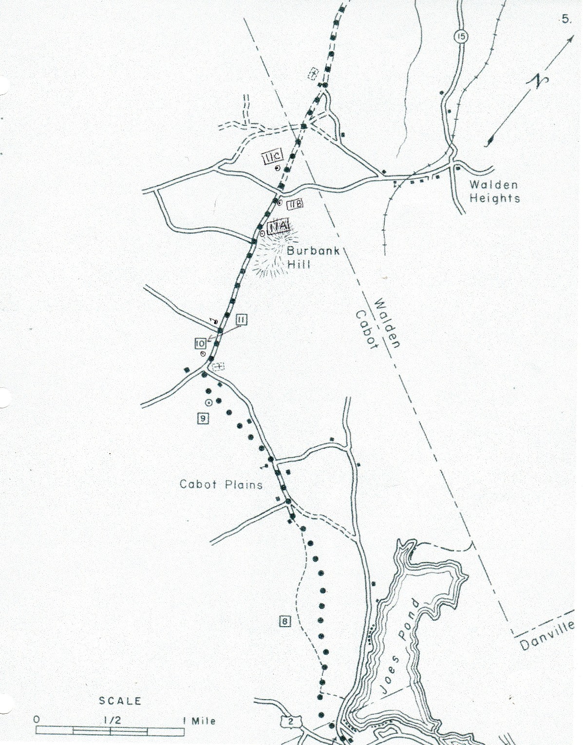
On Cabot Plains, about six miles northwest of Peacham, work halted in mid-June 1776, when Colonel Bayley got word from Gen. Washington that Americans were retreating from Lower Canada. Americans feared completing the road might ease British invasion of New England.
Whatever Congress heard was soon repeated to the British. Washington invented a ruse to mislead the British with an imaginary plan to invade Canada. A sham American army, under Lafayette, would cross Vermont to attack St. Jean, while 8,000 French troops would sail to and attack Quebec.
On March 6, Washington wrote Moses Hazen to march with the 2nd Canadian regiment to Coos:
to know the present disposition of the force in Canada and how it will probably be employed in the spring … While this is doing, your regiment may be employed in extending the road toward the River Sorel or if that shall be deemed too hazardous … you may mend and repair what has been already opened by Colonel Biddle” ( in 1776).
By March 30, 1779, the last division of Hazen’s regiment left camp at Redding, Connecticut, and marched to Springfield, Massachusetts, and on to Charlestown and Haverhill, New Hampshire.
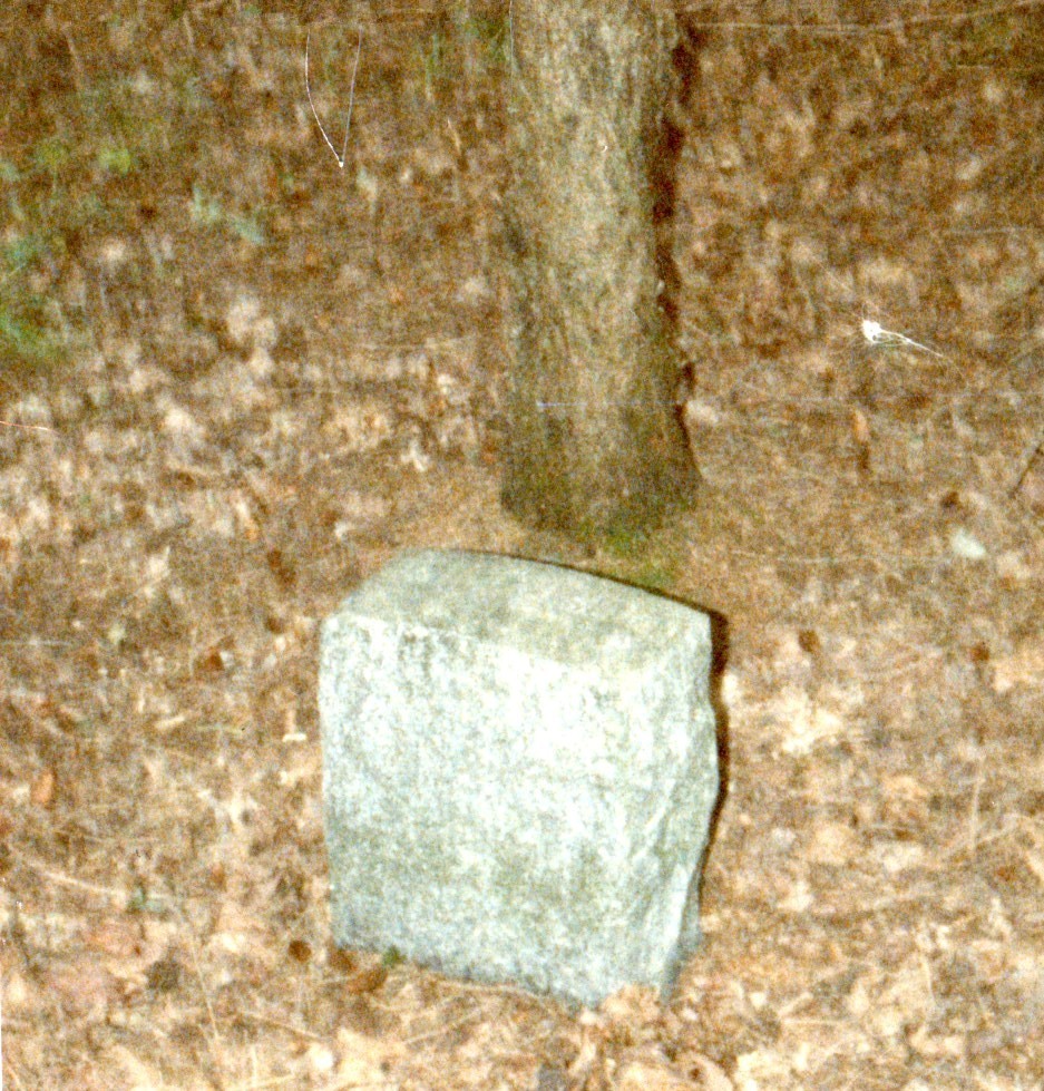
Blockhouses were built and garrisoned at Peacham, Cabot, Walden and Greensboro. At the blockhouse site, called Fortification Hill, in Cabot, there is a granite marker engraved, "Gen. Hazen Camp."
"They built a blockhouse on Fortification Hill, Cabot Plains, and another six miles away in Walden. A third blockhouse was built at Caspian Lake near Greensboro. British, Canadian, and Indian troops followed the road to spy and raid northern New England. In September 1781, two American militia scouts were killed near the blockhouse on Caspian Lake." Four young scouts manned the blockhouse near the southwest corner of Caspian Lake. They were surprised by Indians who killed two and took the other two prisoner to Quebec. Later they were exchanged for prisoners in Vermont.
In a November 20, 1779, letter, Washington divulged to Congress that Hazen’s road:
was for the purpose of exciting jealousies at Quebec and at the enemy’s posts on the St. Lawrence etc., and of making a diversion in favor of the late expedition under General Sullivan, by preventing Reinforcements being sent into the Upper Country to oppose him”.
In the Cabot Historical Society
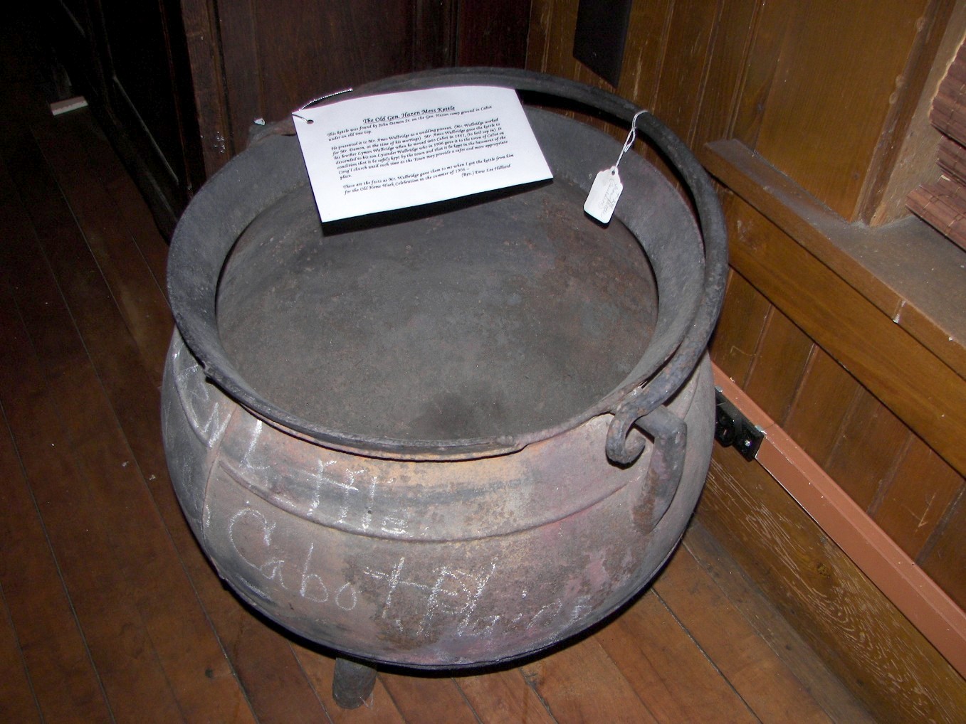
museum, we have this large iron kettle found at the camp site in the early 1800's. It's called Hazen's kettle.
Until the 1970s, trees marked with red paint marked the old roadbed. Now there is scant evidence of the original road. Today's road passes Cabot Plains Cemetery, along the original route. At the foot of a hill past the cemetery, going north, Cabot Plains Road turns left; Bayley-Hazen Road goes straight.
The military road crosses Rte. 215. Nearby is another historical marker. It recalls the shooting of British Brigadier General Gordon, near St. Johns, Lower Canada (Quebec), in 1776. This section was built in 1779 - 80. The road crosses into the Town of Walden near there.
Lt. Benjamin Whitcomb was a scout and sniper who shot Gen. Gordon in July 1776. Later, he commanded two ranger companies.
BENJAMIN WHITCOMB'S INDEPENDENT CORPS OF RANGERS was authorized October 15, 1776. Congress adopted this resolution: "In Congress Assembled - Resolved, That two independent Companies consisting of fifty Men each, be immediately raised to be commanded by Lieutenant Whitcomb, who should be appointed Captain Commandant - that he nominate the Officers of the said two Companies who are to be appointed, when approved by the commanding Officer of the Northern Department." The rangers, from northwest New Hampshire, organized in November, 1776 at Fort Ticonderoga, New York. Their military action began early in 1777.
Note: The shooting of General Gordon depicted in History of the American Revolution Vol. 1, by John Lendrum, J. and B. Williams, 1836, differs significantly from the local tale told in Vermont Historical Magazine of 1867. The shooting did not happen in Cabot. See Shooting General Gordon
Thomas Lyford and his teenage son, Fifield served in Benjamin Whitcomb's Independent Company of Rangers, (and other units). Lyfords were early Cabot settlers. Whitcomb's Rangers
• Lyford, Fifield Private Enlisted 3-1-1778 for 1 year from Northfield NH born ?-?- 1762—16 yrs old discharged 3-?-1779.
Lyford, Fifield Private Enlisted 3-1-1778 for 1 year from Northfield NH born ?-?- 1762—16 yrs old discharged 3-?-1779.
• Lyford, Thomas Lieut Enlisted 11-4-1776 for the duration of the war from Canterbury — 38 yrs old. Thomas Lyford born in Epping, NH 1738; died 15 April, 1804, Cabot, Vt.; m. Mehitable Robinson; lived in Exeter, County (now Northfield), New Ipswich and Sanbornton. Moved to Cabot, Vt., in 1783, third settler there. A millwright, he built the first grist mill in Cabot. Entered the army from Canterbury, NH as 2d Lieut. in Capt. Jeremiah Clough's Co. in 1775, serving until 1781. He was with Gen. Hazen when he built the military road from the Conn. River at Newbury, Vt., via Cabot, towards Canada. Lieut. in Major Whitcomb's Corps of Rangers. Both he and his son, Fifield, also served at West Point under Benedict Arnold. Fifield moved to Cabot in 1788. He also served in the War of 1812.
Smaller forays to gather intelligence continued. Lt. Col. Thomas Johnson, who scouted the original route, was captured by Tory Captain Azariah Pritchard and a party of Canadians and Indians, on March 8, 1781, around 1 a.m. Johnson stayed with Deacon Jonathan Elkins, in Peacham, while building a gristmill. Jonathan Elkins, Jr. and Jacob Page were taken too. Moses Elkins, Jonathan's brother, who was sickly, was allowed to return home, after some eight miles. The prisoners went to Canada. They stopped overnight, on Cabot Plains. For years, the area was called Johnson's Plain and, later, the Plain.
The road was not significant in the war, but after, opened lands north of Newbury for settlers. Those pioneers soon replaced the steep, swampy, military route. They built a road a bit west on a leveler, dryer, ridge. By the mid-1800s, farms, a school, and the Yellow House tavern lined the newer road. For some 30 years, this was the town business center.